Brussels Map Poster: the pentagon, the parks and the European quarter
Why Brussels works so well as a map poster
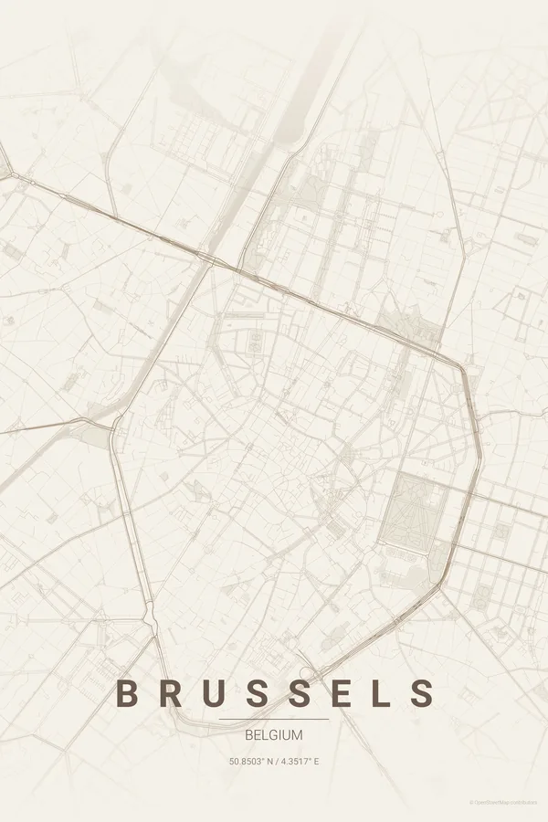
Brussels' historic core sits inside a near-perfect pentagon — the inner ring boulevards that replaced the second city wall — with the Grand-Place at its heart and the green axes of the Parc de Bruxelles and the Cinquantenaire striking out to the east.
Around the pentagon the map turns leafy and grand: Art-Nouveau Ixelles with its ponds, the huge beech forest of the Bois de la Cambre entering from the south, and the European quarter's glass blocks filling the middle ground.
Best palettes for Brussels
- Warm Beige — grand-café cream and gilt — Brussels' natural tones.
- Blueprint — makes the pentagon read like the diagram it is.
- Noir — comic-book ink for the capital of the bande dessinée.
Where to centre the map and which radius to use
Centre on the Grand-Place with a 5 km radius: the pentagon sits centred with the Cinquantenaire's arcade to the east and the Bois de la Cambre entering from the south. The ring reads best in high-contrast palettes.
Ready-made Brussels posters
We have already rendered 5 Brussels designs at 300 DPI (Warm Beige, Blueprint, Japanese Ink, Midnight Blue, Noir). Download the files for 9.99 € and print them anywhere, or order a premium matte print (A4 to 60×90 cm) with shipping included.

See all Brussels designs Order it printed
Design your own Brussels poster
Pick any of the 17 palettes, set the exact centre and radius described above, choose the size and the label text (Brussels, or a neighbourhood name), and we render it for you from live map data after checkout. From 14 €, usually ready in 5–15 minutes.
Which size to print
City maps with lots of fine streets reward size: 30×40 cm is the sweet spot for a desk or hallway, 50×70 cm and 60×90 cm turn the map into a statement piece where individual streets remain legible from across the room. Stick to matte paper so the dark palettes do not reflect. Read the printing and framing guide.