India · Blueprint
Delhi Map Poster · Blueprint
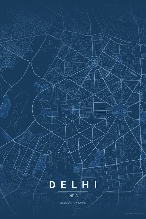
Every street, park and waterway of Delhi, drawn from real map data in the Blueprint palette. Buy the files and print anywhere, or let us print it for you.
- Digital: 4 portrait JPGs (2:3, 3:4, 4:5, ISO) at 300 DPI
- Fits 12×18 in, 30×40 cm, 16×20 in, A4/A3/A2 and more
- Extras ZIP with the 11×14 in version and all ratios in landscape
- Printed sizes A4 to 60×90 cm, $35–$75, shipping included
- Map data © OpenStreetMap contributors
About the Delhi map
Mughal lanes meet Lutyens' geometry
Delhi is two cities on one map. To the north, Old Delhi: the dense Mughal-era tangle around Chandni Chowk, the Jama Masjid and the Red Fort, where lanes knot together so tightly they read as texture. To the south, Lutyens' New Delhi: enormous hexagons and radial avenues converging on India Gate and sweeping down Kartavya Path, one of the most deliberate pieces of urban geometry ever drawn.
A Delhi map poster lives off that collision. The concentric double ring of Connaught Place sits between the two worlds like a bullseye, the Yamuna traces the eastern edge, and the wooded Ridge pushes in from the west. Few capitals show their whole history this clearly from above.
Centre on Connaught Place with an 8 km radius: the frame takes in Old Delhi's tangle, the Red Fort, India Gate, the hexagons of Lutyens' city and a stretch of the Yamuna in one balanced composition.
Read the full Delhi guideWant it your way?
Change the distance, the colours, the label or the size in the editor and get a custom render of Delhi.
Customize this design