Montreal Map Poster: an island city with a mountain at its heart
Why Montreal works so well as a map poster
Montreal is an island in the St. Lawrence, and its map shows it: the river wraps the frame while the green mass of Mount Royal — the mountain that named the city — sits right beside downtown, forcing the street grid to bend respectfully around it.
That grid is its own pleasure: long boulevards like Saint-Laurent and Sherbrooke running parallel to the river, the tight rowhouse blocks of the Plateau, the old stone streets of Vieux-Montréal by the port, and the Jacques Cartier Bridge reaching across to Île Sainte-Hélène and its parklands.

Best palettes for Montreal
- Noir — the signature pick: sleek black on black for long winter nights and a city that loves its jazz.
- Midnight Blue — glowing streets on deep navy, downtown seen from the Mount Royal lookout.
- Blueprint — crisp and technical, a nod to the Expo 67 spirit and the underground city.
Where to centre the map and which radius to use
Centre on Place Ville Marie with a 5 km radius: Mount Royal, the Plateau, Vieux-Montréal, the port and both bridges to Île Sainte-Hélène fall neatly into one frame, with the St. Lawrence closing the composition.
Ready-made Montreal posters
We have already rendered 5 Montreal designs at 300 DPI (Noir, Blueprint, Japanese Ink, Midnight Blue, Warm Beige). Download the files for 9.99 € and print them anywhere, or order a premium matte print (A4 to 60×90 cm) with shipping included.
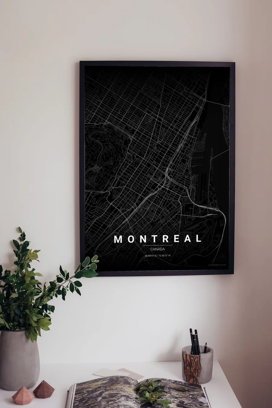
See all Montreal designs Order it printed
Design your own Montreal poster
Pick any of the 17 palettes, set the exact centre and radius described above, choose the size and the label text (Montreal, or a neighbourhood name), and we render it for you from live map data after checkout. From 14 €, usually ready in 5–15 minutes.
Which size to print
City maps with lots of fine streets reward size: 30×40 cm is the sweet spot for a desk or hallway, 50×70 cm and 60×90 cm turn the map into a statement piece where individual streets remain legible from across the room. Stick to matte paper so the dark palettes do not reflect. Read the printing and framing guide.