Malaysia · Warm Beige
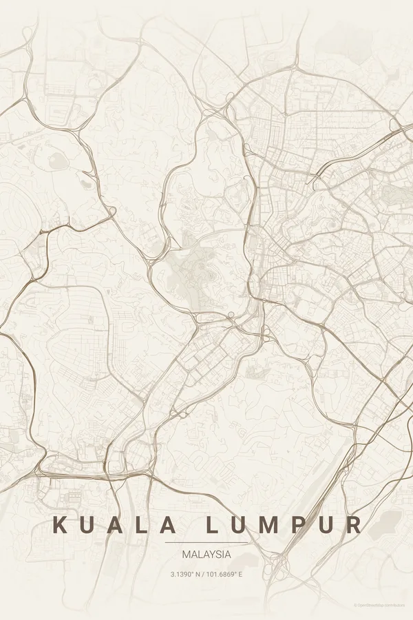
Kuala Lumpur Map Poster · Warm Beige
Every street, park and waterway of Kuala Lumpur, drawn from real map data in the Warm Beige palette. Buy the files and print anywhere, or let us print it for you.
- Digital: 4 portrait JPGs (2:3, 3:4, 4:5, ISO) at 300 DPI
- Fits 12×18 in, 30×40 cm, 16×20 in, A4/A3/A2 and more
- Extras ZIP with the 11×14 in version and all ratios in landscape
- Printed sizes A4 to 60×90 cm, £26–£55, shipping included
- Map data © OpenStreetMap contributors
About the Kuala Lumpur map
rivers, towers and expressways
Kuala Lumpur literally means muddy confluence, and the map shows why: the Klang and Gombak rivers meet right at Masjid Jamek, beside the colonial lawns of Merdeka Square, and that junction is the seed the whole city grew from. Around it, the street pattern is a tropical patchwork rather than a grid.
East of the centre, the KLCC park opens a green hole in the density at the foot of the Petronas Towers, while the old Lake Gardens roll across the hills to the west. Threading through everything are the expressways and rail lines, looping and braiding like circuitry — which is exactly what makes a KL print so distinctive.
Centre on Merdeka Square with a 6 km radius: the river confluence, the Petronas Towers and KLCC park, Bukit Bintang and the Lake Gardens all land in frame, tied together by the braided expressways.
Read the full Kuala Lumpur guideWant it your way?
Change the distance, the colours, the label or the size in the editor and get a custom render of Kuala Lumpur.
Customize this design