United States · Blueprint
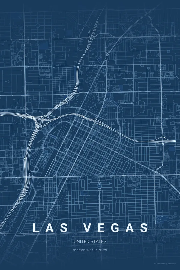
Las Vegas Map Poster · Blueprint
Every street, park and waterway of Las Vegas, drawn from real map data in the Blueprint palette. Buy the files and print anywhere, or let us print it for you.
- Digital: 4 portrait JPGs (2:3, 3:4, 4:5, ISO) at 300 DPI
- Fits 12×18 in, 30×40 cm, 16×20 in, A4/A3/A2 and more
- Extras ZIP with the 11×14 in version and all ratios in landscape
- Printed sizes A4 to 60×90 cm, £26–£55, shipping included
- Map data © OpenStreetMap contributors
About the Las Vegas map
the Strip, the grid and the desert
Las Vegas from above is a diagram of the American desert city. The compact grid of downtown and Fremont Street sits at the north, and from it Las Vegas Boulevard — the Strip — runs on its own diagonal south past the mega-resorts, cutting across the mile-spaced lattice of arterial roads that organises the whole valley.
Beyond the arterials, the map dissolves into master-planned loops and cul-de-sacs, golf courses and washes, with the mountains ringing the valley just off frame. No river, no old town: just pure, unapologetic geometry that reads like a glowing circuit board — especially in the right theme.
Centre on Fremont Street with an 8 km radius: the downtown grid and the full run of the Strip down to the mega-resorts fit in one frame, with the suburban loops fading out towards the edges.
Read the full Las Vegas guideWant it your way?
Change the distance, the colours, the label or the size in the editor and get a custom render of Las Vegas.
Customize this design