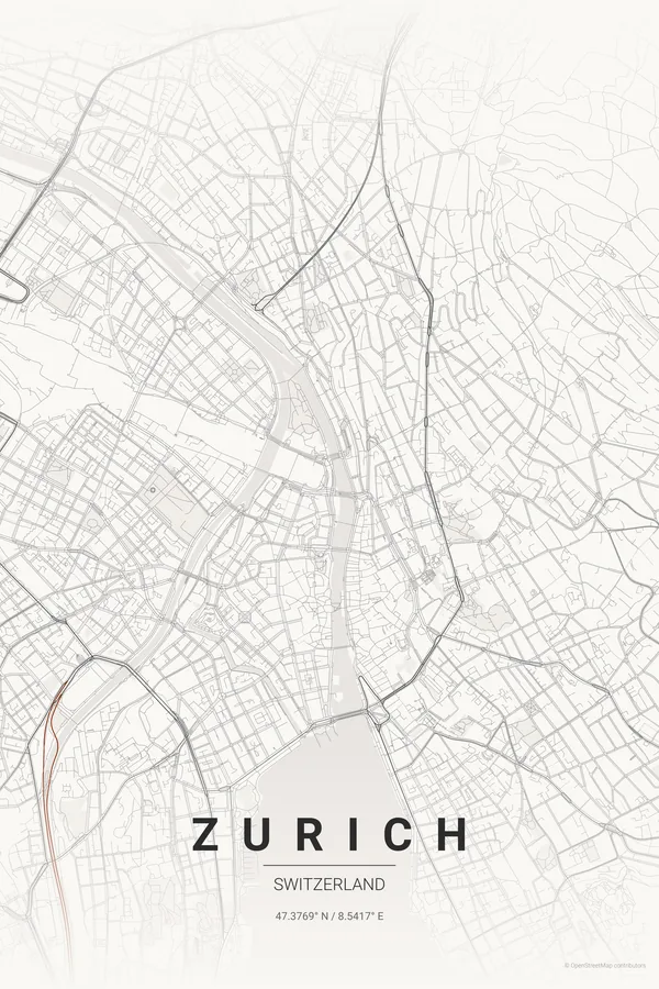
Switzerland · Japanese Ink
Zurich Map Poster · Japanese Ink
Every street, park and waterway of Zurich, drawn from real map data in the Japanese Ink palette. Buy the files and print anywhere, or let us print it for you.
- Digital: 4 portrait JPGs (2:3, 3:4, 4:5, ISO) at 300 DPI
- Fits 12×18 in, 30×40 cm, 16×20 in, A4/A3/A2 and more
- Extras ZIP with the 11×14 in version and all ratios in landscape
- Printed sizes A4 to 60×90 cm, £26–£55, shipping included
- Map data © OpenStreetMap contributors
About the Zurich map
where the Limmat leaves the lake
Zurich's composition is a gift: the lake enters the frame from the south like a broad blue wedge, narrows to a point at the Bürkliplatz, and becomes the Limmat, which threads the old town's two banks before curving away north-west.
Either side of that waterline, the city climbs — the Niederdorf's medieval lanes on the right bank, the banking district and Bahnhofstrasse on the left, and the wooded ridges of Uetliberg and Zürichberg framing everything in green.
Centre on Paradeplatz with a 5 km radius: the lake's wedge takes the lower third and the Limmat draws a bright line up the middle. Zurich is compact — 3 km makes a beautiful old-town-only print too.
Read the full Zurich guideWant it your way?
Change the distance, the colours, the label or the size in the editor and get a custom render of Zurich.
Customize this design


