Tokyo Map Poster: the beautiful chaos of Japan's capital
Why Tokyo works so well as a map poster
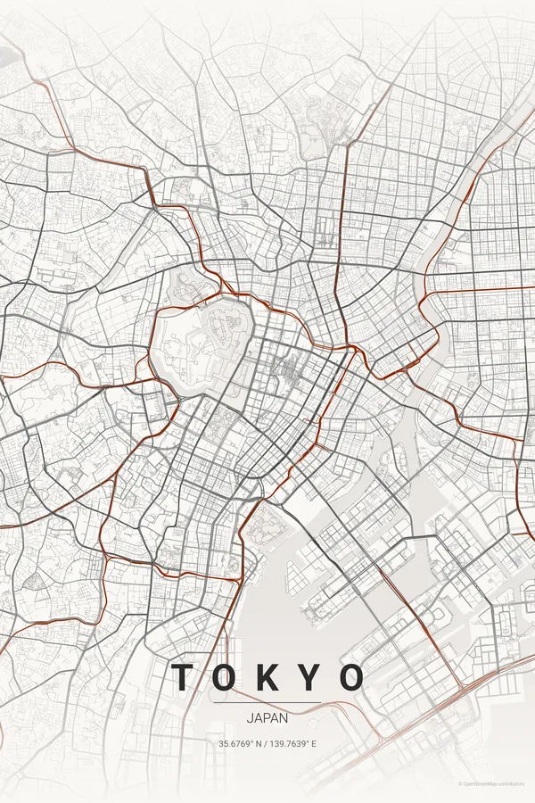
Tokyo's map is unlike any other city. There is no grid and no grand boulevards, just an incredibly dense web of small streets radiating from the stations, punctuated by the Imperial Palace gardens, the Sumida River and pockets of green like Yoyogi and Ueno.
That is what makes a Tokyo map poster so fascinating: from above it looks almost like a living organism, with the Yamanote loop holding the centre together and the rivers and canals of the east side adding rhythm.
Best palettes for Tokyo
- Japanese Ink — designed for this city: sumi-e inspired, minimal, stunning.
- Midnight Blue — deep navy with glowing streets, like Tokyo at night from above.
- Blueprint — technical and precise; honours the engineering of the world's largest metro system.
Where to centre the map and which radius to use
Centre on the Imperial Palace with an 8 km radius so the empty green of the palace becomes the eye of the storm, surrounded by Shinjuku, Shibuya, Ginza and the Sumida. Tokyo is so dense that a 10 km radius still reads as one continuous texture.
Ready-made Tokyo posters
We have already rendered 5 Tokyo designs at 300 DPI (Japanese Ink, Blueprint, Midnight Blue, Noir, Warm Beige). Download the files for 9.99 € and print them anywhere, or order a premium matte print (A4 to 60×90 cm) with shipping included.

See all Tokyo designs Order it printed
Design your own Tokyo poster
Pick any of the 17 palettes, set the exact centre and radius described above, choose the size and the label text (Tokyo, or a neighbourhood name), and we render it for you from live map data after checkout. From 14 €, usually ready in 5–15 minutes.
Which size to print
City maps with lots of fine streets reward size: 30×40 cm is the sweet spot for a desk or hallway, 50×70 cm and 60×90 cm turn the map into a statement piece where individual streets remain legible from across the room. Stick to matte paper so the dark palettes do not reflect. Read the printing and framing guide.